Fish species benefit from multi-agency collaborations
May 15, 2014
Among the many multi-agency collaborations that have benefited the college and the environment, a recent project studies aquatic organism passage in streams. “Teams in the Pacific Northwest concentrate on trout and salmon, whereas our team at Virginia Tech and the U.S Forest Service (USFS) Center for Aquatic Technology Transfer (CATT) is looking at nongame animals, including darters, creek chubs, and other minnows and crayfish,” said Andy Dolloff, adjunct associate professor and director of the CATT.
The research can answer questions such as whether fish are moving through barriers (e.g., culverts under roads) and if they are moving only downstream or upstream. “We use microchips in fish just like you put in your dog or cat,” said Dolloff. “Our team is also working with another USFS-university team at the University of Massachusetts on a genetics study to detect whether chub and other species are isolated by potential barriers such as culverts.”
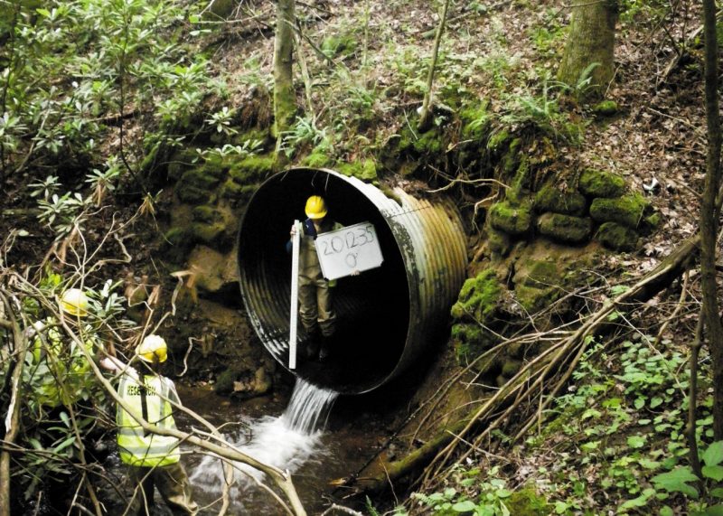
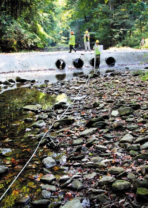
Culverts with a significant drop from one end to the other, too shallow water depth, or smooth pipes that do not have natural substrate may create velocity barriers that prevent fish from moving, especially in the upstream direction. Since 2006, an ongoing partnership between the USFS-CATT and the college has been at work to identify and evaluate the passage status of the estimated 50,000-plus culverts in southern national forests. The resulting database can be queried by managers who need to know where barriers are located and which barriers can be removed or altered to achieve a desired result for a given level of funding.
But how does a manager decide which problems to tackle first? Enter the Crossing Area Decision Support System (CADSS), a GIS- based decision management tool developed by CATT biologist Craig Roghair and Conservation Management Institute researcher Laura Roghair and colleagues. CADSS analyzes information on species distributions, land ownership, crossing location, difficulty of fish passage, and other user-defined preferences to recommend crossings or combinations of crossings for replacement or upgrade. Outputs include a top-10 list and maps of reconnected stream reaches, allowing managers to quickly visualize different replacement scenarios. “The result can be presented as a color-coded map of the forest road system showing various possibilities,” Dolloff explained.
Photos courtesy of the U.S. Forest Service Center for Aquatic Technology Transfer.
Related Links
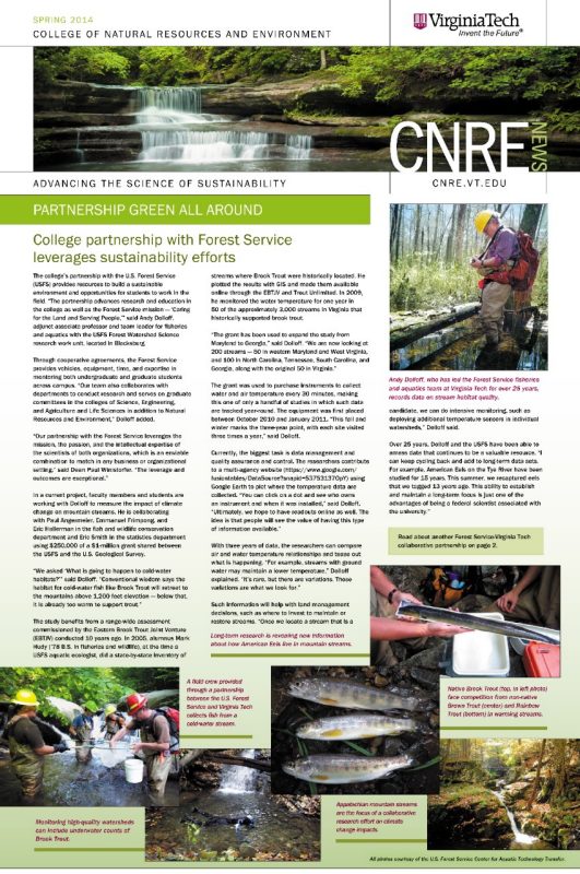
College partnership with Forest Service leverages sustainability efforts
Through cooperative agreements, the Forest Service provides vehicles, equipment, time, and expertise in mentoring both undergraduate and graduate students across campus.