Researchers address riverbank erosion in Bangladesh
May 15, 2018
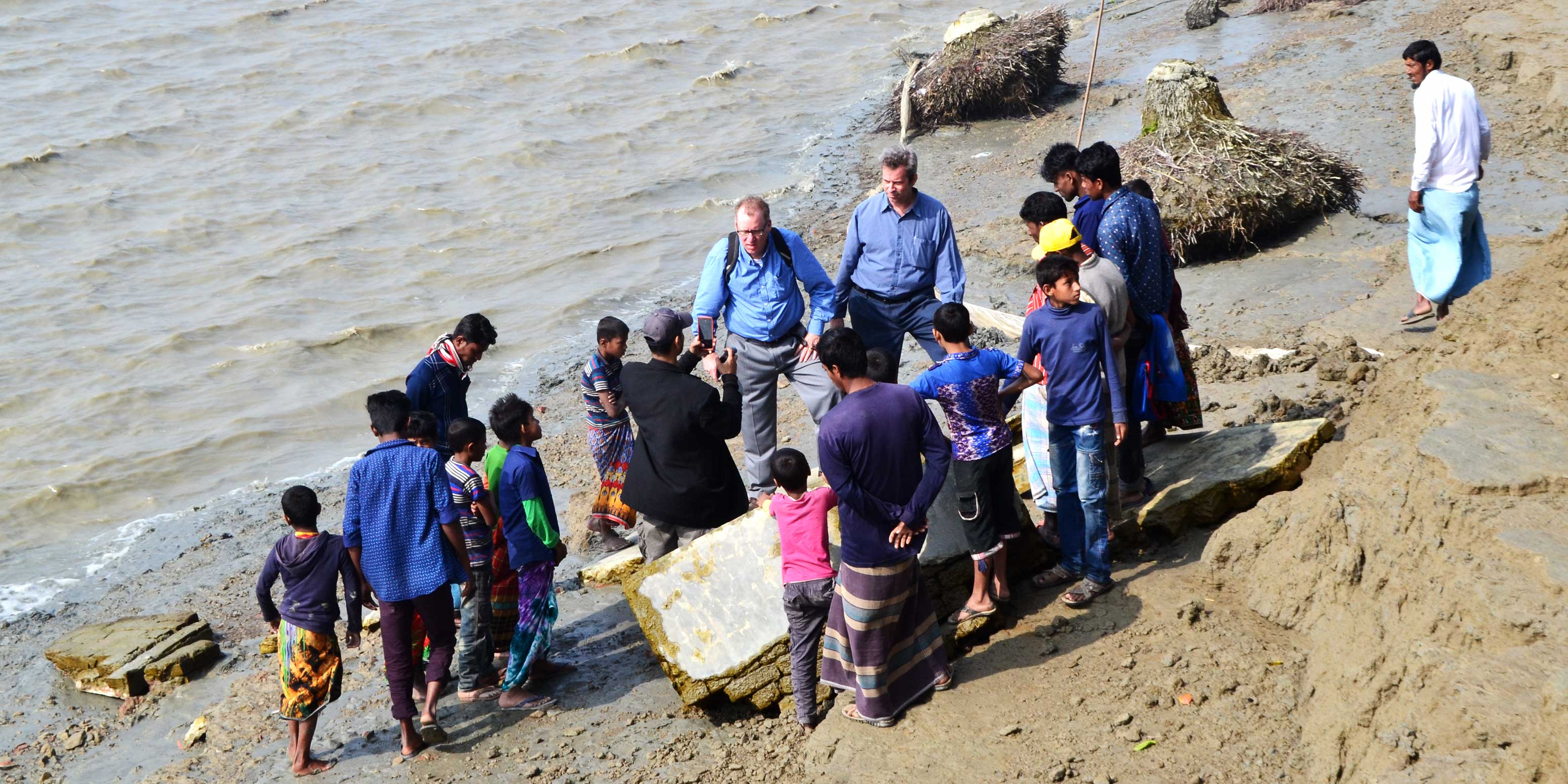
Members of the research team examine erosion along the Lower Meghna River in Bangladesh during a January 2018 field visit, accompanied by local villagers. Pictured are (left to right in center of photo) Munshi Khaledur Rahman (in black jacket), Tom Crawford (in blue shirt and gray slacks), and Scott Curtis of East Carolina University (in blue shirt and blue slacks).

Coastal residents in Bangladesh are losing their homes and farmland at an astonishing rate due to riverbank erosion, which affects roughly 1 million people and displaces 50,000 to 200,000 every year. Professor Tom Crawford and postdoctoral associate Munshi Khaledur Rahman of the Department of Geography are part of a team working to develop a predictive model for major erosion events similar to that for hurricanes in the U.S.
“We want to understand how coastal erosion is linked to precipitation patterns and how humans are continuing to secure their livelihoods in the face of erosion,” Crawford said. “Ultimately, we’d like to be able to develop a predictive early-warning model that will help alert villagers if rainfall and erosion are going to be particularly bad in a given year.”
The team, which includes researchers from three other universities, is conducting a three-year study funded by the National Science Foundation on coastal erosion, human vulnerability, and adaptation strategies to promote resilience in the face of erosion disturbances.
In January, team members visited two villages that will serve as study sites, where 400 households will be surveyed. Crawford and Rahman will also use satellite images captured between 1988 and 2018 to plot spatiotemporal patterns of erosion and generate location-specific annual rates of erosion and erosion variability.
“We’re trying to bring science into the real world and solve real-life problems,” Rahman said. “We hope that the findings of this study will benefit the communities in Bangladesh that are suffering due to riverbank erosion and address global environmental issues through scientific contributions to the discipline.”
Read the full press release.


