New technology has endless applications for natural resources management
November 15, 2016
Understanding landscapes and their assets is vital for sound management of natural resources. But in remote areas, the time and cost associated with data collection can hinder research efforts. Through the use of unmanned aircraft systems (UAS), commonly referred to as drones, college researchers are working to overcome those limitations.
According to John McGee, professor and Virginia Cooperative Extension geospatial specialist, unmanned aircraft systems — comprised of the aircraft, flight-planning software, camera and sensor technology, and data post-processing software — represent a new opportunity for scientists to understand and interact with natural areas. “This technology provides data on demand,” he said. “We can capture images and data about abiotic, biotic, and cultural resources and can more efficiently ‘map’ a landscape.”
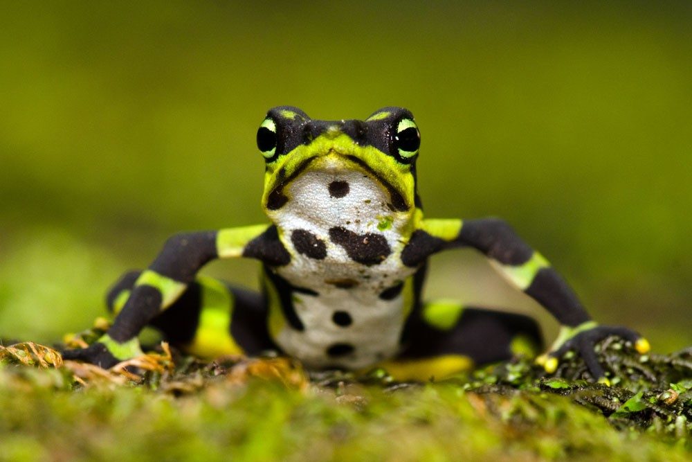
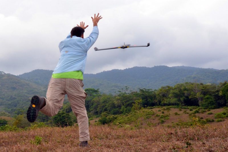
McGee tested the technology’s versatility during a trip to Panama in 2015. Data collected by a UAS were used to generate a detailed, high-resolution baseline map of the Cocobolo Nature Reserve, a 1,000-acre rain forest and biodiversity hot spot. Researchers from Panama and the U.S. have been working to inventory natural resources in Cocobolo, but struggled to obtain the necessary imagery from high-resolution satellites.
Working with Daniel Cross, a UAS operator and GIS technician with the college’s Conservation Management Institute, McGee and his team collected imagery of the rain forest with approximately 1-inch resolution. “With these data, local scientists can identify individual tree species based on the imagery by examining canopy size, shape, texture, and color,” Cross explained.
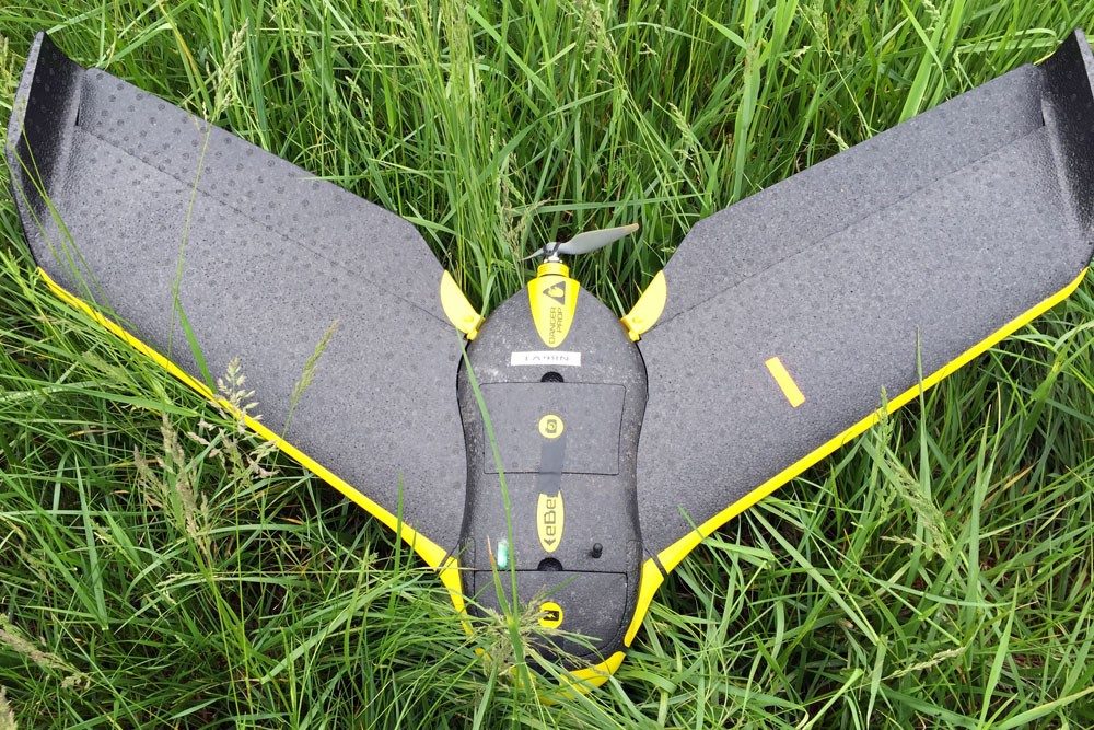
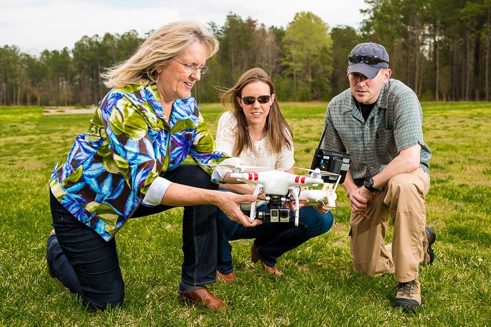
The college currently uses three UAS devices, including a small 1.5-pound fixed-wing eBee. They can be outfitted with a variety of cameras and sensors depending on the specific needs of each project.
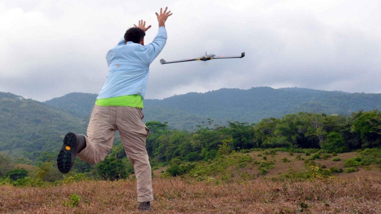
The eBee flies autonomously, operating on parameters provided through the flight-planning software prior to launching. It continually monitors wind speed, wind direction, and other data, and adjusts its flight to current conditions. The operator can also monitor environmental conditions and modify the flight plan while the aircraft is airborne.
“Infrared cameras can help us to discern chlorophyll vigor to determine whether a section of a field might be stressed due to low nitrogen levels, or we can use thermal sensors to identify areas that might be experiencing heat loss,” McGee pointed out. Sensors can even indicate where historical structures or foundations may be buried underground. There are countless potential applications for the technology in natural resources management, including inventorying and monitoring forest health, assessing soil erosion and crop health, and conducting wildlife inventories.
In addition to providing incredibly diverse sets of data, UAS aircraft like the eBee can cover hundreds of acres in a relatively short amount of time, making them a potentially cost-effective option for conducting inventories on large tracts of land. “In the past we had to contract with an aerial photography company, and then wait until their schedule and the weather both allowed for a flight,” McGee said.
Now, researchers can collect data much more rapidly and frequently. According to Cross, UAS technology collects data in near-real time. “A 20- to 30-minute flight takes about three to four hours of preparation, and we can get results back within hours or days,” he said. In addition, UAS technology can collect information over several occasions and at specific times that cannot be obtained relying on commercial image providers, and may reduce the need for extra manpower during field studies.
Cross, a licensed pilot who is currently the college’s only UAS operator, begins each flight with extensive planning. “You have to know the area you’re flying well, and understand property boundaries, obstacles, and airspace restrictions before you can develop a flight plan. Safety is our primary concern.”
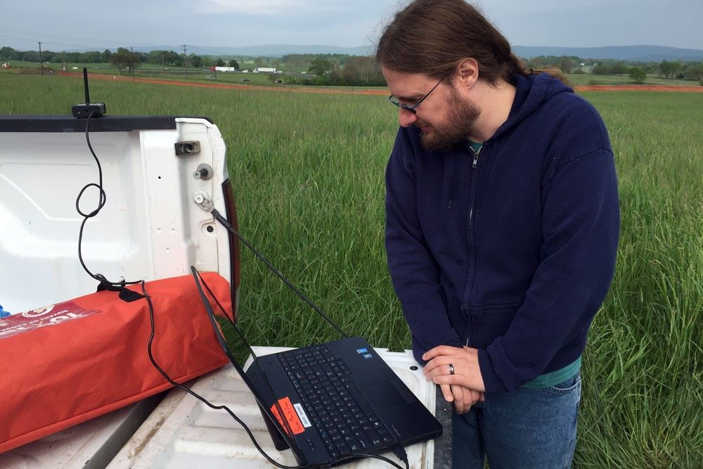
Once the preplanning is complete, there is very little actual flight time. “I prepare a flight plan, specify what information to collect, and then I monitor the flight via laptop,” he said. The bulk of the work comes in the post-processing stages. After a flight, Cross reviews the data to determine if the UAS retrieved the information needed.
Until late August, the Federal Aviation Administration required that anyone piloting a UAS have a pilot’s license, but new regulations have paved the way for others to pilot the aircrafts. The college will soon train additional faculty and staff to become FAA certified UAS pilots.
For McGee, this development represents an exciting opportunity for growth, particularly within the Virginia Tech community. “This industry is getting ready to explode,” he explained. “Demand for technicians who can operate all facets of a UAS is going to increase significantly. Industries everywhere will be using this technology, so we need to make sure the foundation is in place.”
To help ensure that students are well equipped to handle the rapidly changing technology, McGee has partnered with the Virginia Space Grant Consortium and the Virginia Community College System on a project to develop academic courses and pathways to help students master the skills necessary to become UAS operations technicians in a range of industries. Through a grant from the National Science Foundation, he is working with faculty to develop courses designed to teach students how to plan and fly UAS missions and analyze the geospatial data they collect. The grant is the latest in a long-term partnership to bring geospatial technology to community college curriculums in order to meet the growing workforce need for trained technicians.
“This project is directly serving Virginia’s communities, by providing workforce development opportunities associated with an emerging and potentially transformative industry,” McGee explained. “In addition, it is important to provide community college students with a technical-based educational pathway prior to attending a four-year college or university. This way, the students who come to Virginia Tech will have the UAS operational skills already in place to further enhance their academic experience, contribute to research programs, and support UAS-based outreach and service learning initiatives.